
Machen topographic map
Interactive map
Click on the map to display elevation.
About this map
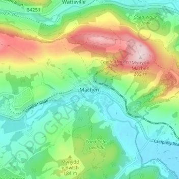
Name: Machen topographic map, elevation, terrain.
Average elevation: 143 m
Minimum elevation: 35 m
Maximum elevation: 362 m
Other topographic maps
Click on a map to view its topography, its elevation and its terrain.
Ystrad Mynach
Vereinigtes Königreich > Wales > Caerphilly County Borough > Hengoed
Ystrad Mynach, Gelligaer, Hengoed, Caerphilly County Borough, Wales, Vereinigtes Königreich
Average elevation: 160 m