
Thank you for supporting this site ❤️
Make a donation
Make a donation
Lida topographic map
Click on the map to display elevation.
Thank you for supporting this site ❤️
Make a donation
Make a donation
About this map
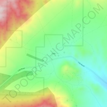
Name: Lida topographic map, elevation, terrain.
Location: Lida, Esmeralda County, Nevada, United States (37.43826 -117.51814 37.47826 -117.47814)
Average elevation: 1,965 m
Minimum elevation: 1,782 m
Maximum elevation: 2,270 m
Thank you for supporting this site ❤️
Make a donation
Make a donation
Other topographic maps
Click on a map to view its topography, its elevation and its terrain.