
Djura topographic map
Interactive map
Click on the map to display elevation.
About this map
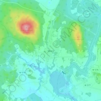
Name: Djura topographic map, elevation, terrain.
Average elevation: 177 m
Minimum elevation: 151 m
Maximum elevation: 284 m
Other topographic maps
Click on a map to view its topography, its elevation and its terrain.
Hedby
Sweden > Dalecarlia > Djura > Hedby
Hedby, Djura, Leksands kommun, Dalecarlia, Region Svealand, Sweden
Average elevation: 234 m