
Thank you for supporting this site ❤️
Make a donation
Make a donation
Lintong Nihuta topographic map
Click on the map to display elevation.
Thank you for supporting this site ❤️
Make a donation
Make a donation
About this map
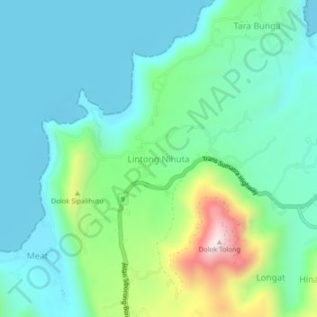
Name: Lintong Nihuta topographic map, elevation, terrain.
Location: Lintong Nihuta, Toba, North Sumatra, Sumatra, 22312, Indonesia (2.31388 98.99819 2.35388 99.03819)
Average elevation: 1,033 m
Minimum elevation: 893 m
Maximum elevation: 1,489 m
Thank you for supporting this site ❤️
Make a donation
Make a donation
Other topographic maps
Click on a map to view its topography, its elevation and its terrain.