
Make a donation
Mohali topographic map
Click on the map to display elevation.
Make a donation
About this map
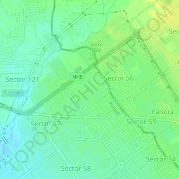
Name: Mohali topographic map, elevation, terrain.
Average elevation: 326 m
Minimum elevation: 317 m
Maximum elevation: 336 m
Make a donation
Other topographic maps
Click on a map to view its topography, its elevation and its terrain.
Make a donation
Ludhiana District
The topography of the district is a typical representative of an alluvial plain. It owes its origin to the aggravation work of the Satluj River. The alluvium deposited by the river has been worked over by the wind, which gave rise to a number of small dunes and sand mounds. Most of these dunes have been…
Average elevation: 246 m
Make a donation
Make a donation
Make a donation
Make a donation
Patiala
India > Punjab > Patiala Tahsil
Patiala is located at 30°19′N 76°24′E / 30.32°N 76.40°E / 30.32; 76.40. It has an average elevation of 250 metres (820 feet). During the short existence of PEPSU, Patiala served as its capital city.
Average elevation: 255 m
Make a donation
Make a donation
Make a donation
Make a donation