
南坑村 topographic map
Interactive map
Click on the map to display elevation.
About this map
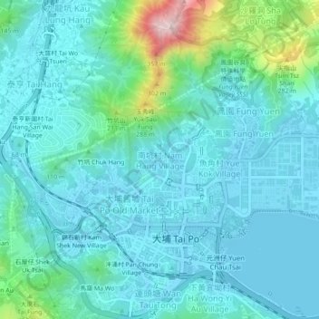
Name: 南坑村 topographic map, elevation, terrain.
Location: 南坑村, 南坑, 大埔區, 新界, 香港, 中国 (22.43921 114.14898 22.47921 114.18898)
Average elevation: 68 m
Minimum elevation: -8 m
Maximum elevation: 418 m
Other topographic maps
Click on a map to view its topography, its elevation and its terrain.