
Thạch Hà District topographic map
Interactive map
Click on the map to display elevation.
About this map
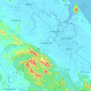
Name: Thạch Hà District topographic map, elevation, terrain.
Location: Thạch Hà District, Hà Tĩnh Province, Vietnam (18.17102 105.73329 18.47205 106.02498)
Average elevation: 36 m
Minimum elevation: -3 m
Maximum elevation: 456 m
Other topographic maps
Click on a map to view its topography, its elevation and its terrain.
Hương Khê District
Hương Khê District, Hà Tĩnh Province, 46003, Vietnam
Average elevation: 262 m