
Thank you for supporting this site ❤️
Make a donation
Make a donation
Tinizong topographic map
Click on the map to display elevation.
Thank you for supporting this site ❤️
Make a donation
Make a donation
About this map
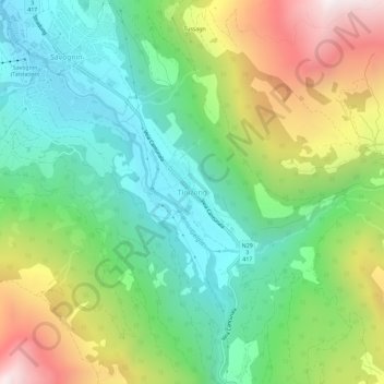
Name: Tinizong topographic map, elevation, terrain.
Location: Tinizong, Surses, Albula, Grigioni, 7453, Svizzera (46.56278 9.59715 46.60278 9.63715)
Average elevation: 1,623 m
Minimum elevation: 1,155 m
Maximum elevation: 2,475 m
Thank you for supporting this site ❤️
Make a donation
Make a donation