
龙蟠乡 topographic map
Interactive map
Click on the map to display elevation.
About this map
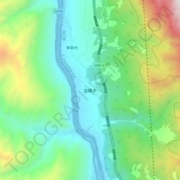
Name: 龙蟠乡 topographic map, elevation, terrain.
Location: 龙蟠乡, 丽江市, 云南省, 中国 (27.05564 100.02983 27.13564 100.10983)
Average elevation: 2,377 m
Minimum elevation: 1,806 m
Maximum elevation: 3,853 m
Other topographic maps
Click on a map to view its topography, its elevation and its terrain.