
Thank you for supporting this site ❤️
Make a donation
Make a donation
Prague topographic map
Click on the map to display elevation.
Thank you for supporting this site ❤️
Make a donation
Make a donation
About this map
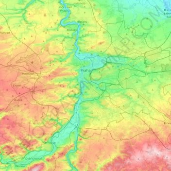
Name: Prague topographic map, elevation, terrain.
Location: Prague, obvod Praha 4, Prague, Czechia (49.94190 14.22444 50.17743 14.70679)
Average elevation: 300 m
Minimum elevation: 167 m
Maximum elevation: 508 m
Thank you for supporting this site ❤️
Make a donation
Make a donation