
Bingley topographic map
Interactive map
Click on the map to display elevation.
About this map
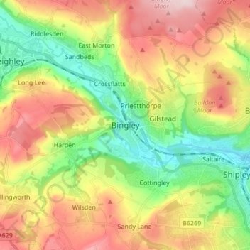
Name: Bingley topographic map, elevation, terrain.
Location: Bingley, Yorkshire and the Humber, Engeland, BD16 2LZ, VK (53.80795 -1.87845 53.88795 -1.79845)
Average elevation: 186 m
Minimum elevation: 64 m
Maximum elevation: 337 m