
Thank you for supporting this site ❤️
Make a donation
Make a donation
Bennington topographic map
Click on the map to display elevation.
Thank you for supporting this site ❤️
Make a donation
Make a donation
About this map
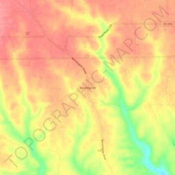
Name: Bennington topographic map, elevation, terrain.
Location: Bennington, Switzerland County, Indiana, United States (38.83895 -85.16051 38.87895 -85.12051)
Average elevation: 263 m
Minimum elevation: 204 m
Maximum elevation: 291 m
Thank you for supporting this site ❤️
Make a donation
Make a donation
Other topographic maps
Click on a map to view its topography, its elevation and its terrain.