
Thank you for supporting this site ❤️
Make a donation
Make a donation
Kemutug Lor topographic map
Click on the map to display elevation.
Thank you for supporting this site ❤️
Make a donation
Make a donation
About this map
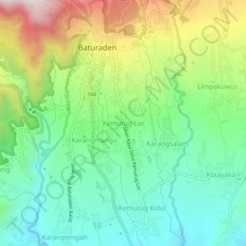
Name: Kemutug Lor topographic map, elevation, terrain.
Location: Kemutug Lor, Banyumas, Central Java, Java, 53151, Indonesia (-7.34714 109.21379 -7.30714 109.25379)
Average elevation: 513 m
Minimum elevation: 314 m
Maximum elevation: 889 m
Thank you for supporting this site ❤️
Make a donation
Make a donation
Other topographic maps
Click on a map to view its topography, its elevation and its terrain.