
Thank you for supporting this site ❤️
Make a donation
Make a donation
Tokoriki topographic map
Click on the map to display elevation.
Thank you for supporting this site ❤️
Make a donation
Make a donation
About this map
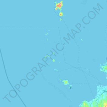
Name: Tokoriki topographic map, elevation, terrain.
Location: Tokoriki, Nadroga-Navosa, Western, Fiji (-17.89602 176.77181 -17.25602 177.41181)
Average elevation: 2 m
Minimum elevation: 0 m
Maximum elevation: 486 m
Thank you for supporting this site ❤️
Make a donation
Make a donation
Other topographic maps
Click on a map to view its topography, its elevation and its terrain.