
Thank you for supporting this site ❤️
Make a donation
Make a donation
Haardt topographic map
Click on the map to display elevation.
Thank you for supporting this site ❤️
Make a donation
Make a donation
Haardt
Im Westen wird der Gebirgszug durch die Lambrechter Verwerfung vom inneren Pfälzerwald abgegrenzt. Diese nach der Stadt Lambrecht benannte Störungslinie verläuft in einem Abstand von etwa 2 bis 5 km parallel zum Grabenrand und hat zur Versetzung verschiedener Gesteinsschichten um 80 bis 100 m geführt. Deshalb sind in der Haardt z. B. die Formationen des Unteren oder Mittleren Buntsandsteins in entsprechend geringerer Höhe als weiter im Westen anzutreffen.
Thank you for supporting this site ❤️
Make a donation
Make a donation
About this map
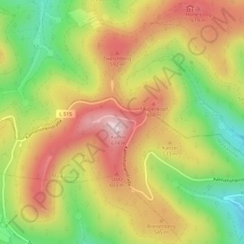
Name: Haardt topographic map, elevation, terrain.
Average elevation: 484 m
Minimum elevation: 280 m
Maximum elevation: 671 m
Thank you for supporting this site ❤️
Make a donation
Make a donation