
Thank you for supporting this site ❤️
Make a donation
Make a donation
El M'dig topographic map
Click on the map to display elevation.
Thank you for supporting this site ❤️
Make a donation
Make a donation
About this map
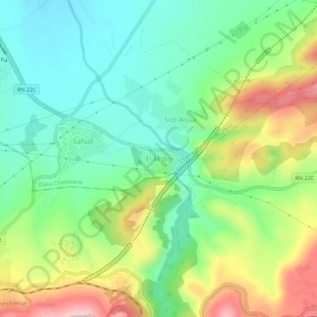
Name: El M'dig topographic map, elevation, terrain.
Location: El M'dig, Chetouane, Tlemcen, 13022, Algeria (34.87772 -1.28430 34.91772 -1.24430)
Average elevation: 685 m
Minimum elevation: 561 m
Maximum elevation: 911 m
Thank you for supporting this site ❤️
Make a donation
Make a donation