
Whitehall topographic map
Interactive map
Click on the map to display elevation.
About this map
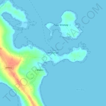
Name: Whitehall topographic map, elevation, terrain.
Location: Whitehall, Orcades, Écosse, KW17 2AR, Royaume-Uni (59.12130 -2.61762 59.16130 -2.57762)
Average elevation: 5 m
Minimum elevation: -1 m
Maximum elevation: 42 m
Other topographic maps
Click on a map to view its topography, its elevation and its terrain.
Stromness
Royaume-Uni > Écosse > Orcades
Stromness, Orcades, Écosse, KW16 3BU, Royaume-Uni
Average elevation: 21 m