
Thank you for supporting this site ❤️
Make a donation
Make a donation
Village group Malealea topographic map
Click on the map to display elevation.
Thank you for supporting this site ❤️
Make a donation
Make a donation
About this map
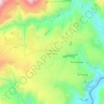
Name: Village group Malealea topographic map, elevation, terrain.
Location: Village group Malealea, Mafeteng District, Lesotho (-29.84992 27.58693 -29.80992 27.62693)
Average elevation: 1,742 m
Minimum elevation: 1,509 m
Maximum elevation: 2,076 m
Thank you for supporting this site ❤️
Make a donation
Make a donation
Other topographic maps
Click on a map to view its topography, its elevation and its terrain.