
Luilu topographic map
Interactive map
Click on the map to display elevation.
About this map
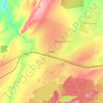
Name: Luilu topographic map, elevation, terrain.
Location: Luilu, Mutshatsha, Lualaba, Democratic Republic of the Congo (-10.70311 25.35042 -10.62311 25.43042)
Average elevation: 1,424 m
Minimum elevation: 1,316 m
Maximum elevation: 1,501 m
Other topographic maps
Click on a map to view its topography, its elevation and its terrain.
Musonoie
Democratic Republic of the Congo > Lualaba > Mutshatsha
Musonoie, Mutshatsha, Lualaba, Democratic Republic of the Congo
Average elevation: 1,462 m