
草津白根山 topographic map
Interactive map
Click on the map to display elevation.
About this map
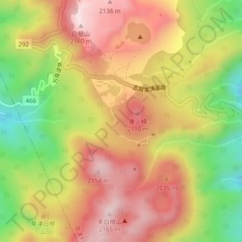
Name: 草津白根山 topographic map, elevation, terrain.
Location: 草津白根山, 草津町, 吾妻郡, Préfecture de Gunma, Kantō, Japon (36.63320 138.53329 36.63330 138.53339)
Average elevation: 1,975 m
Minimum elevation: 1,740 m
Maximum elevation: 2,160 m