
Cortenaz topographic map
Interactive map
Click on the map to display elevation.
About this map
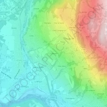
Name: Cortenaz topographic map, elevation, terrain.
Average elevation: 656 m
Minimum elevation: 455 m
Maximum elevation: 1,076 m
Other topographic maps
Click on a map to view its topography, its elevation and its terrain.
Bellevue
France > Auvergne-Rhône-Alpes > Haute-Savoie > Lucinges
Bellevue, Lucinges, Saint-Julien-en-Genevois, Haute-Savoie, Auvergne-Rhône-Alpes, France métropolitaine, 74380, France
Average elevation: 890 m
Lachaud
France > Auvergne-Rhône-Alpes > Haute-Savoie > Lucinges
Lachaud, Lucinges, Saint-Julien-en-Genevois, Haute-Savoie, Auvergne-Rhône-Alpes, France métropolitaine, 74380, France
Average elevation: 921 m