
Gyazhugling topographic map
Interactive map
Click on the map to display elevation.
About this map
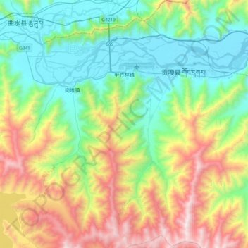
Name: Gyazhugling topographic map, elevation, terrain.
Location: Gyazhugling, Gonggar County, Lhoka, Tibet, China (29.06244 90.83369 29.38369 91.00655)
Average elevation: 4,162 m
Minimum elevation: 3,560 m
Maximum elevation: 5,440 m