
Thank you for supporting this site ❤️
Make a donation
Make a donation
Parque Centenario topographic map
Click on the map to display elevation.
Thank you for supporting this site ❤️
Make a donation
Make a donation
About this map
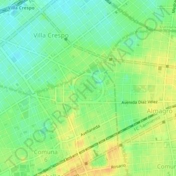
Name: Parque Centenario topographic map, elevation, terrain.
Average elevation: 24 m
Minimum elevation: 10 m
Maximum elevation: 38 m
Thank you for supporting this site ❤️
Make a donation
Make a donation
Other topographic maps
Click on a map to view its topography, its elevation and its terrain.
Villa 1-11-14 Barrio Padre Ricciardelli
Argentina > Ciudad Autónoma de Buenos Aires > Buenos Aires
Average elevation: 11 m
Parque Leonardo Pereyra
Argentina > Ciudad Autónoma de Buenos Aires > Buenos Aires
Average elevation: 9 m