
Los Ángeles topographic map
Interactive map
Click on the map to display elevation.
About this map
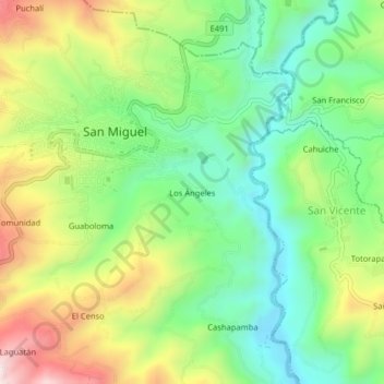
Name: Los Ángeles topographic map, elevation, terrain.
Location: Los Ángeles, San Miguel, Bolívar, 020302, Ecuador (-1.73462 -79.05412 -1.69462 -79.01412)
Average elevation: 2,458 m
Minimum elevation: 2,247 m
Maximum elevation: 2,790 m
Other topographic maps
Click on a map to view its topography, its elevation and its terrain.
Guaboloma
Ecuador > Bolívar > San Miguel > San Miguel
Guaboloma, San Miguel, Bolívar, 020301, Ecuador
Average elevation: 2,549 m