
Markhausen topographic map
Interactive map
Click on the map to display elevation.
About this map
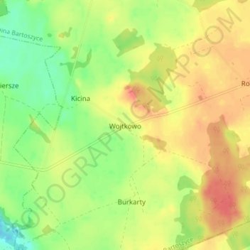
Name: Markhausen topographic map, elevation, terrain.
Average elevation: 92 m
Minimum elevation: 66 m
Maximum elevation: 115 m
Other topographic maps
Click on a map to view its topography, its elevation and its terrain.
Hanshagen
Polen > Woiwodschaft Ermland-Masuren > powiat bartoszycki
Hanshagen, Gemeinde Landsberg, powiat bartoszycki, Woiwodschaft Ermland-Masuren, 11-220, Polen
Average elevation: 145 m