
Thank you for supporting this site ❤️
Make a donation
Make a donation
Hamilton County topographic map
Click on the map to display elevation.
Thank you for supporting this site ❤️
Make a donation
Make a donation
About this map
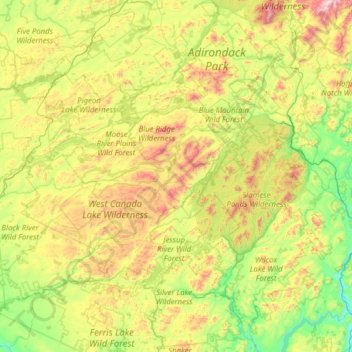
Name: Hamilton County topographic map, elevation, terrain.
Location: Hamilton County, New York, United States (43.21467 -74.86770 44.12041 -74.04610)
Average elevation: 574 m
Minimum elevation: 172 m
Maximum elevation: 1,567 m
Thank you for supporting this site ❤️
Make a donation
Make a donation
Other topographic maps
Click on a map to view its topography, its elevation and its terrain.