
Thank you for supporting this site ❤️
Make a donation
Make a donation
Yining City topographic map
Click on the map to display elevation.
Thank you for supporting this site ❤️
Make a donation
Make a donation
About this map
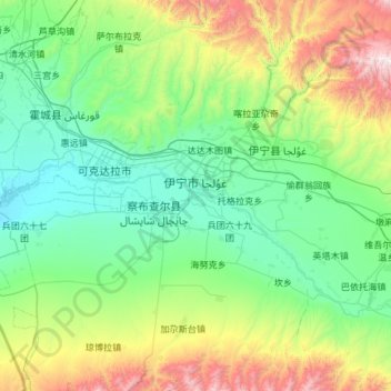
Name: Yining City topographic map, elevation, terrain.
Location: Yining City, Ili, Xinjiang, China (43.44477 81.02693 44.30105 81.49591)
Average elevation: 1,035 m
Minimum elevation: 540 m
Maximum elevation: 3,094 m
Thank you for supporting this site ❤️
Make a donation
Make a donation