
Mile Gully topographic map
Interactive map
Click on the map to display elevation.
About this map
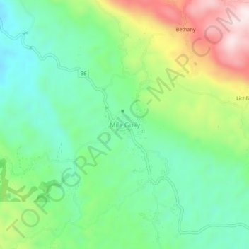
Name: Mile Gully topographic map, elevation, terrain.
Location: Mile Gully, Manchester, Middlesex County, Jamaica (18.11772 -77.56657 18.15772 -77.52657)
Average elevation: 558 m
Minimum elevation: 373 m
Maximum elevation: 914 m
Other topographic maps
Click on a map to view its topography, its elevation and its terrain.