
Bagmati River topographic map
Interactive map
Click on the map to display elevation.
About this map
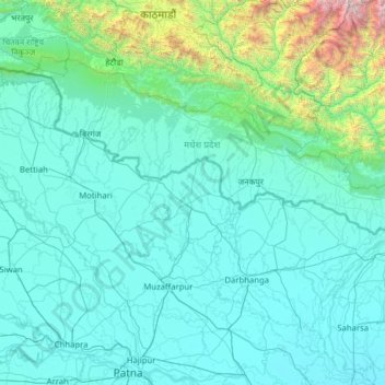
Name: Bagmati River topographic map, elevation, terrain.
Location: Bagmati River, Sītāmarhi, Sitamarhi, Bihar, 843321, India (25.53594 85.23161 27.78393 86.72235)
Average elevation: 422 m
Minimum elevation: 32 m
Maximum elevation: 6,590 m
Other topographic maps
Click on a map to view its topography, its elevation and its terrain.