
Thank you for supporting this site ❤️
Make a donation
Make a donation
Motnik topographic map
Click on the map to display elevation.
Thank you for supporting this site ❤️
Make a donation
Make a donation
About this map
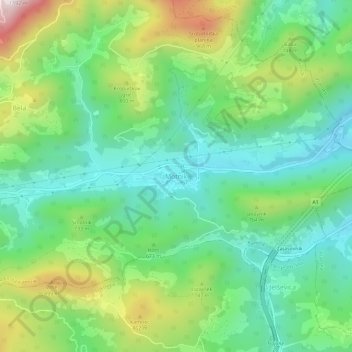
Name: Motnik topographic map, elevation, terrain.
Location: Motnik, Kamnik, Upravna Enota Kamnik, 1221, Slovenië (46.19556 14.86587 46.23556 14.90587)
Average elevation: 636 m
Minimum elevation: 396 m
Maximum elevation: 1,144 m
Thank you for supporting this site ❤️
Make a donation
Make a donation