
Thank you for supporting this site ❤️
Make a donation
Make a donation
Hillsgrove topographic map
Click on the map to display elevation.
Thank you for supporting this site ❤️
Make a donation
Make a donation
About this map
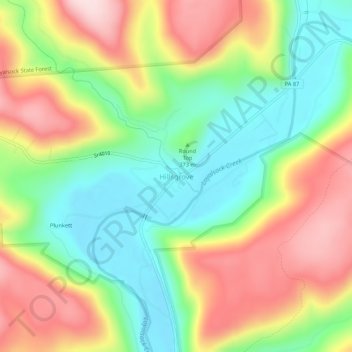
Name: Hillsgrove topographic map, elevation, terrain.
Average elevation: 393 m
Minimum elevation: 245 m
Maximum elevation: 582 m
Thank you for supporting this site ❤️
Make a donation
Make a donation
Other topographic maps
Click on a map to view its topography, its elevation and its terrain.
Worlds End State Park
United States > Pennsylvania > Sullivan County > Forks Township
There was even a dispute as to the proper name of the area. Some people called it Worlds End, others Whirl's Glen, and still others Whirls End. The first name arose from the topography of the place. Seven mountain ranges converge on the point and one does receive the sensation of being at the ultimate ends of…
Average elevation: 489 m
Thank you for supporting this site ❤️
Make a donation
Make a donation