
Thank you for supporting this site ❤️
Make a donation
Make a donation
Archem topographic map
Click on the map to display elevation.
Thank you for supporting this site ❤️
Make a donation
Make a donation
About this map
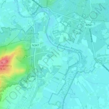
Name: Archem topographic map, elevation, terrain.
Location: Archem, Lemele, Ommen, Overijssel, Nederland, 8148 PG, Nederland (52.45593 6.41907 52.49593 6.45907)
Average elevation: 11 m
Minimum elevation: 2 m
Maximum elevation: 75 m
Thank you for supporting this site ❤️
Make a donation
Make a donation
Other topographic maps
Click on a map to view its topography, its elevation and its terrain.