
West Devon topographic map
Interactive map
Click on the map to display elevation.
About this map
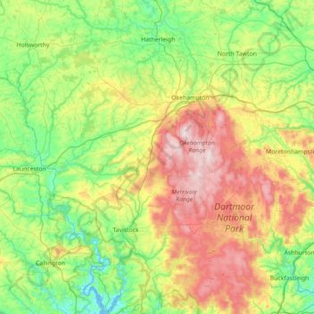
Name: West Devon topographic map, elevation, terrain.
Location: West Devon, Devon, South West England, Inglaterra, Reino Unido (50.42937 -4.33510 50.87462 -3.73227)
Average elevation: 200 m
Minimum elevation: -1 m
Maximum elevation: 612 m
Other topographic maps
Click on a map to view its topography, its elevation and its terrain.
Dartmoor
Reino Unido > Inglaterra > West Devon
Dartmoor, Clapper Bridge, Dartmoor Forest, West Devon, Devon, South West England, Inglaterra, PL20 6TJ, Reino Unido
Average elevation: 239 m