
La Mesa de Los Santos topographic map
Interactive map
Click on the map to display elevation.
About this map
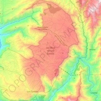
Name: La Mesa de Los Santos topographic map, elevation, terrain.
Average elevation: 1,253 m
Minimum elevation: 303 m
Maximum elevation: 2,290 m
Other topographic maps
Click on a map to view its topography, its elevation and its terrain.
Mirador Salto del Duende
Colombia > Santander > Los Santos
Mirador Salto del Duende, Los Santos, Metropolitana, Santander, Colombia
Average elevation: 1,462 m