
Thank you for supporting this site ❤️
Make a donation
Make a donation
Pesaro topographic map
Click on the map to display elevation.
Thank you for supporting this site ❤️
Make a donation
Make a donation
About this map
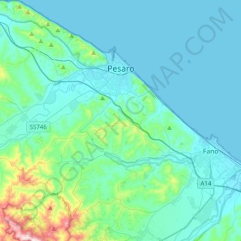
Name: Pesaro topographic map, elevation, terrain.
Location: Pesaro, Pesaro e Urbino, Marche, Italy (43.76916 12.77096 43.96547 12.96283)
Average elevation: 70 m
Minimum elevation: -3 m
Maximum elevation: 551 m
Thank you for supporting this site ❤️
Make a donation
Make a donation
Other topographic maps
Click on a map to view its topography, its elevation and its terrain.