Geolocate

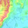
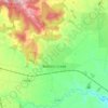
Carlsruhe topographic map

Click on the map to display elevation.

About this map

Name: Carlsruhe topographic map, elevation, terrain.

Location: Carlsruhe, Shire of Macedon Ranges, Victoria, Australia (-37.30206 144.48152 -37.26206 144.52152)

Average elevation: 533 m

Minimum elevation: 510 m

Maximum elevation: 580 m

Other topographic maps

Click on a map to view its topography, its elevation and its terrain.

Goldie

Australia > Victoria

Average elevation: 504 m

Yarra Glen

Australia > Victoria > Melbourne

Average elevation: 128 m

Werribee River

Australia > Victoria

Average elevation: 281 m

Melbourne

Australia > Victoria

Average elevation: 102 m

Wilsons Promontory

Australia > Victoria

Average elevation: 38 m

Caroline Springs

Australia > Victoria > Melbourne

Average elevation: 92 m

St Andrews

Australia > Victoria > Melbourne

Average elevation: 211 m

Bairnsdale

Australia > Victoria

A comprehensive geological survey of Victoria's Great Dividing Range reveals a distinct north-south alignment in its bedrock, a vestige of the bygone epochs of plate tectonics. This enduring geological framework, coupled with ongoing tectonic activity, contributes to the dynamic topography witnessed in the…

Average elevation: 25 m

Lysterfield

Australia > Victoria > Melbourne

Average elevation: 128 m

Bright

Australia > Victoria

Average elevation: 550 m

Somers

Australia > Victoria > Melbourne

Average elevation: 13 m

Deer Park

Australia > Victoria > Melbourne

Average elevation: 59 m

Eynesbury

Australia > Victoria > Melbourne

Average elevation: 103 m

Riddells Creek

Australia > Victoria

Average elevation: 436 m

Wingan River

Australia > Victoria

Average elevation: 101 m