
Thank you for supporting this site ❤️
Make a donation
Make a donation
Rusumo topographic map
Click on the map to display elevation.
Thank you for supporting this site ❤️
Make a donation
Make a donation
About this map
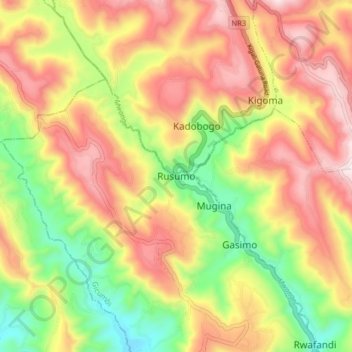
Name: Rusumo topographic map, elevation, terrain.
Location: Rusumo, Gicumbi, Northern Province, Rwanda (-1.71342 30.05236 -1.63342 30.13236)
Average elevation: 1,870 m
Minimum elevation: 1,537 m
Maximum elevation: 2,185 m
Thank you for supporting this site ❤️
Make a donation
Make a donation
Other topographic maps
Click on a map to view its topography, its elevation and its terrain.