
Adipur topographic map
Interactive map
Click on the map to display elevation.
About this map
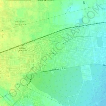
Name: Adipur topographic map, elevation, terrain.
Location: Adipur, Gandhidham Taluka, Kachchh, Gujarat, 370205, India (23.05345 70.07061 23.09345 70.11061)
Average elevation: 30 m
Minimum elevation: 21 m
Maximum elevation: 39 m
Other topographic maps
Click on a map to view its topography, its elevation and its terrain.
Gandhidham
India > Gujarat > Gandhidham Taluka
Gandhidham, Gandhidham Taluka, Kachchh, Gujarat, 370210, India
Average elevation: 17 m