
Thank you for supporting this site ❤️
Make a donation
Make a donation
Liotloaneng topographic map
Click on the map to display elevation.
Thank you for supporting this site ❤️
Make a donation
Make a donation
About this map
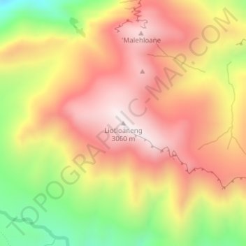
Name: Liotloaneng topographic map, elevation, terrain.
Location: Liotloaneng, Berea District, Lesotho (-29.22425 28.21825 -29.22415 28.21835)
Average elevation: 2,791 m
Minimum elevation: 2,411 m
Maximum elevation: 3,062 m
Thank you for supporting this site ❤️
Make a donation
Make a donation
Other topographic maps
Click on a map to view its topography, its elevation and its terrain.