
Thank you for supporting this site ❤️
Make a donation
Make a donation
Srinagar topographic map
Click on the map to display elevation.
Thank you for supporting this site ❤️
Make a donation
Make a donation
About this map
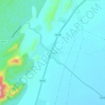
Name: Srinagar topographic map, elevation, terrain.
Location: Srinagar, Nasirabad Tehsil, Ajmer, Rajasthan, 305525, India (26.41461 74.76100 26.45461 74.80100)
Average elevation: 469 m
Minimum elevation: 431 m
Maximum elevation: 732 m
Thank you for supporting this site ❤️
Make a donation
Make a donation