
Thank you for supporting this site ❤️
Make a donation
Make a donation
Poroto topographic map
Click on the map to display elevation.
Thank you for supporting this site ❤️
Make a donation
Make a donation
About this map
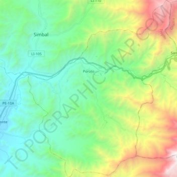
Name: Poroto topographic map, elevation, terrain.
Location: Poroto, Province of Trujillo, La Libertad, Peru (-8.11176 -78.82641 -7.94378 -78.68304)
Average elevation: 1,168 m
Minimum elevation: 224 m
Maximum elevation: 3,469 m
Thank you for supporting this site ❤️
Make a donation
Make a donation
Other topographic maps
Click on a map to view its topography, its elevation and its terrain.
Thank you for supporting this site ❤️
Make a donation
Make a donation
Thank you for supporting this site ❤️
Make a donation
Make a donation