
Thank you for supporting this site ❤️
Make a donation
Make a donation
Maggia topographic map
Click on the map to display elevation.
Thank you for supporting this site ❤️
Make a donation
Make a donation
About this map
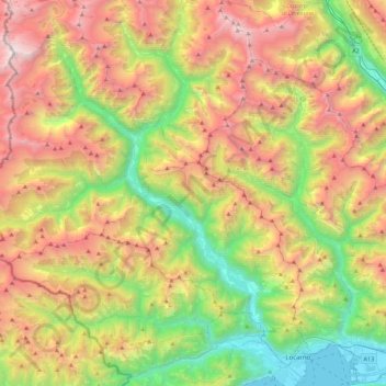
Name: Maggia topographic map, elevation, terrain.
Location: Maggia, District de Vallemaggia, Tessin, Suisse (46.14658 8.54932 46.48689 8.80501)
Average elevation: 1,572 m
Minimum elevation: 188 m
Maximum elevation: 3,234 m
Thank you for supporting this site ❤️
Make a donation
Make a donation
Other topographic maps
Click on a map to view its topography, its elevation and its terrain.