
Khemis Milana topographic map
Interactive map
Click on the map to display elevation.
About this map
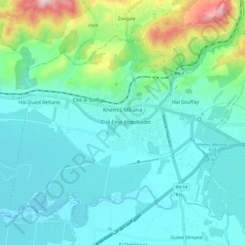
Name: Khemis Milana topographic map, elevation, terrain.
Location: Khemis Milana, Daïra Khemis Meliana, Aïn Defla, Algérie (36.22171 2.17289 36.29018 2.27250)
Average elevation: 346 m
Minimum elevation: 250 m
Maximum elevation: 758 m
Other topographic maps
Click on a map to view its topography, its elevation and its terrain.
Sidi Lakhdar
Algérie > Aïn Defla > Daïra Khemis Meliana
Sidi Lakhdar, Daïra Khemis Meliana, Aïn Defla, 44027, Algérie
Average elevation: 312 m