
Thank you for supporting this site ❤️
Make a donation
Make a donation
Ayock topographic map
Click on the map to display elevation.
Thank you for supporting this site ❤️
Make a donation
Make a donation
About this map
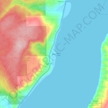
Name: Ayock topographic map, elevation, terrain.
Location: Ayock, Mason County, Washington, United States (47.48731 -123.07682 47.52731 -123.03682)
Average elevation: 65 m
Minimum elevation: -2 m
Maximum elevation: 213 m
Thank you for supporting this site ❤️
Make a donation
Make a donation
Other topographic maps
Click on a map to view its topography, its elevation and its terrain.
Thank you for supporting this site ❤️
Make a donation
Make a donation
Thank you for supporting this site ❤️
Make a donation
Make a donation