
Neosho County topographic map
Interactive map
Click on the map to display elevation.
About this map
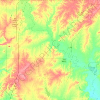
Name: Neosho County topographic map, elevation, terrain.
Location: Neosho County, Kansas, United States (37.38372 -95.52614 37.73420 -95.08763)
Average elevation: 290 m
Minimum elevation: 256 m
Maximum elevation: 329 m
Other topographic maps
Click on a map to view its topography, its elevation and its terrain.
Girard
United States > Kansas > Girard
Girard, Crawford County, Kansas, 66743, United States
Average elevation: 298 m