
Daaquam topographic map
Interactive map
Click on the map to display elevation.
About this map
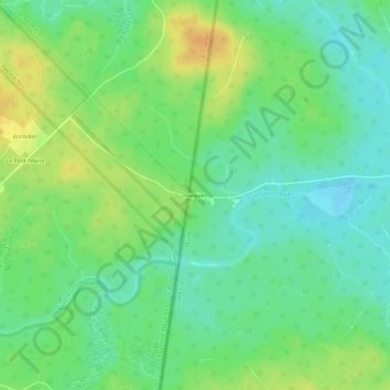
Name: Daaquam topographic map, elevation, terrain.
Average elevation: 347 m
Minimum elevation: 333 m
Maximum elevation: 366 m
Other topographic maps
Click on a map to view its topography, its elevation and its terrain.
Rivière Saint-François
États-Unis d'Amérique > Maine > Aroostook County
Rivière Saint-François, T19 R11 WELS, Aroostook County, Maine, États-Unis d'Amérique
Average elevation: 326 m