
Thank you for supporting this site ❤️
Make a donation
Make a donation
Vagem topographic map
Click on the map to display elevation.
Thank you for supporting this site ❤️
Make a donation
Make a donation
About this map
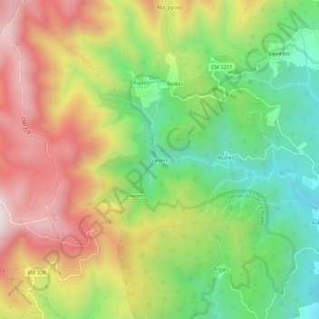
Name: Vagem topographic map, elevation, terrain.
Location: Vagem, Sul, São Pedro do Sul, Viseu, 3660-615, Portugal (40.81687 -8.09645 40.85687 -8.05645)
Average elevation: 580 m
Minimum elevation: 221 m
Maximum elevation: 1,004 m
Thank you for supporting this site ❤️
Make a donation
Make a donation