
Thank you for supporting this site ❤️
Make a donation
Make a donation
Brukom topographic map
Click on the map to display elevation.
Thank you for supporting this site ❤️
Make a donation
Make a donation
About this map
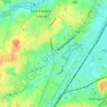
Name: Brukom topographic map, elevation, terrain.
Average elevation: 39 m
Minimum elevation: 21 m
Maximum elevation: 72 m
Thank you for supporting this site ❤️
Make a donation
Make a donation
Other topographic maps
Click on a map to view its topography, its elevation and its terrain.
Berchem-Saint-Laurent
Belgique > Brabant flamand > Hal-Vilvorde > Leeuw-Saint-Pierre
Average elevation: 46 m