
Thank you for supporting this site ❤️
Make a donation
Make a donation
Santara topographic map
Click on the map to display elevation.
Thank you for supporting this site ❤️
Make a donation
Make a donation
About this map
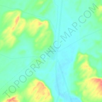
Name: Santara topographic map, elevation, terrain.
Location: Santara, Gira Tehsil, Balotra, Rajasthan, 344037, India (25.99950 71.93560 26.03950 71.97560)
Average elevation: 155 m
Minimum elevation: 135 m
Maximum elevation: 202 m
Thank you for supporting this site ❤️
Make a donation
Make a donation