
Graide-Station topographic map
Interactive map
Click on the map to display elevation.
About this map
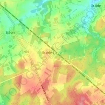
Name: Graide-Station topographic map, elevation, terrain.
Location: Graide-Station, Bièvre, Dinant, Namen, Wallonië, 5555, België (49.91352 5.02186 49.95352 5.06186)
Average elevation: 389 m
Minimum elevation: 346 m
Maximum elevation: 436 m